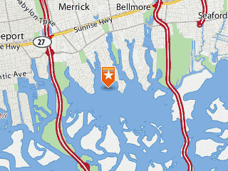
Merrick station location.
Sea Conditions at
Merrick
New York USA
Latitude 40 degrees 38.6 minutes North
Longitude 73 degrees 32.4 minutes West
Page last updated 12/31/1969 19:00 EST
Station status: Station operating normally.
| Water Level and Water Temperature at Blue Water Yacht Club | ||||
| Latest Observation Time | Latest Value | Average, last 24 hr | Maximum, last 24 hr | Minimum, last 24 hr |
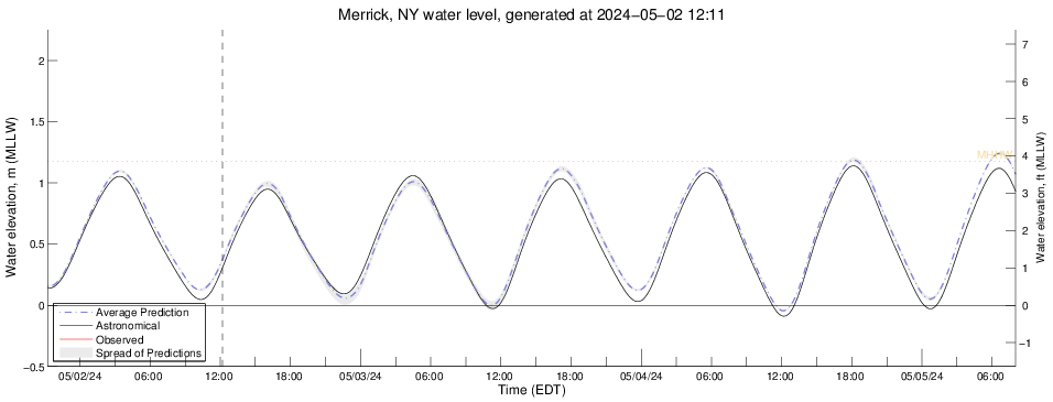
| Water level, NGVD29 03-09 21:00 EST |
0.28 m (0.92 ft) | 0.35 m (1.16 ft) | 0.80 m
(2.63 ft) at 03/08 23:36 EST |
-0.15 m
(-0.50 ft) at 03/08 17:54 EST |
| Water temperature 03-09 21:00 EST |
5.04 C (41 F) | 4.20 C (40 F) | 5.53 C
(42 F) at 03/08 18:12 EST |
0.58 C
(33 F) at 03/09 13:42 EST |
| Weather Observations | |||
| Time | Last Updated on Mar 9 2025, 10:00 pm EDT | Maximum, last 24 hr | Minimum, last 24 hr |
| Average wind speed | 2.0 mph |
17.0 mph at 4:22pm |
|
| Wind direction | West-southwest : 248 deg true | ||
| Air temperature | 44.1 deg F (6.7 deg C) |
53.1 deg F (11.72 deg C)
at 6:05pm |
32.4 deg F (0.22 deg C)
at 7:48am |
| Barometric pressure | 30.249 in Hg (1024.3 mbar) |
30.349 in Hg ( mbar)
at 8:47am |
30.176 in Hg ( mbar)
at 5:16pm |
| Barometer - 1 hour trend | Rising Slowly | ||
Weather Forecast for Merrick, NY
Tonight Mostly Clear |
| Lo 40 °F |
Monday Sunny |
| Hi 61 °F |
| Monday Night Mostly Clear |
| Lo 39 °F |
| Tuesday Sunny |
| Hi 54 °F |
| Tuesday Night Mostly Clear |
| Lo 39 °F |
Wednesday Mostly Sunny |
| Hi 50 °F |
Phase of the Moon
Sunrise: 07:11 AM EDT
Sunset: 06:54 PM EDT
NOTES:
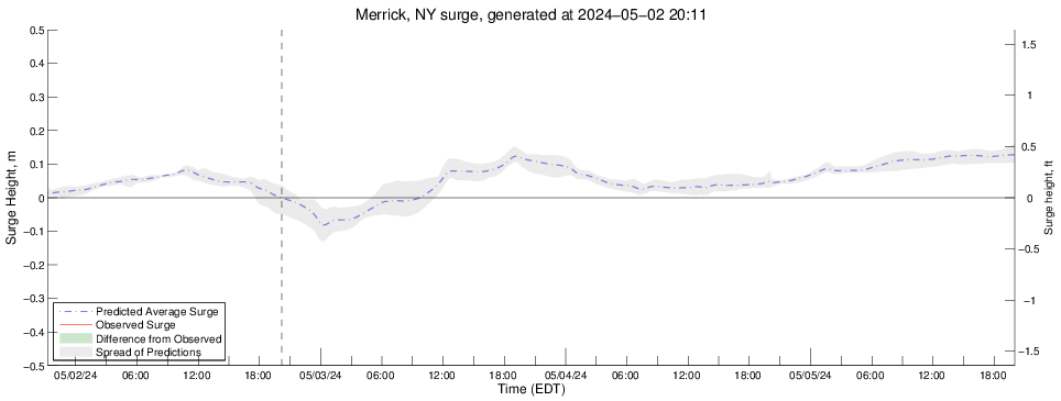
- The Storm Surge model is under development and predictions for sea level height are for research purposes only. They should never be used for navigational purposes or emergency planning under any circumstances.
- Real-time data are unchecked and preliminary. Please read this disclaimer.
- NGVD29 = measurement referenced to National Geodetic Vertical Datum of 1929.
- Weather forecast provided by the US National Weather Service in Upton, NY.

About LIShore |
Data Access |
LIShore Home |
Photographs and maps |
Help LIShore grow |
Disclaimer
 LIShore is a project of the School of Marine and Atmospheric Sciences at Stony Brook University in collaboration with the LIShore partners.